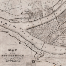
Geographic Information Systems are tools that allow you to manipulate spatial data. Spatial data include vector data (e.g., shapefiles), raster images (e.g., GeoTIFFs), LiDAR, and others. Spatial inquiry and analysis is of growing interest in multiple disciplines. Students and scholars in the humanities, social sciences, and sciences can all utilize spatial narratives to tell stories and provide context to their research. In the libraries, we can help with your project in various ways. Learn more about our services below.
The GIS Services Team in the University Libraries can help you (or your students, colleagues):
- Learn about spatial data
- Find specific data for your projects
- Learn how to use some GIS tools
- Find maps to support your projects
- Learn how to make a visually appealing map
- Plan for spatial data collection and storage
Our services are available for everyone in the CMU Community and our workshops and events are open to all in the Western PA Region. Some of the specific ways we can help include:
- Instruction sessions & workshops for your course, club, or other group
- One-on-one consultations focused on your specific project
- Brainstorming sessions to fine tune the goals and purpose of your spatial project
Already know what you need? Send us a message.
Not sure what you need and want to chat with someone first?
Schedule a Virtual Consultation Schedule an In Person Consultation
GIS Tools
The Heinz College provides access to ArcGIS Software for CMU affiliates. Instructions for accessing the suite of ArcGIS tools can be found on the Heinz Computing Website under ERSI. Another option is an open source tool called QGIS. QGIS is free, open source and works natively on Apple devices as well as Windows devices. You can download the tool from the QGIS website.
Primary Contact(s)
Manage
Manage Information & Data
Work with our specialists to evaluate, select, and implement the tools to organize your data and keep your project on track.


